Terra Future Seminar, Ordnance Survey, Southampton, 10th March 2010
The Linked Data movement was once again in rude health at last week’s ‘Terra Future’ seminar where it joined forces with the UK GIS crowd at the Ordnance Survey HQ on a sun soaked Southampton morning.
Peter ter Haar from Ordnance Survey opened the day by raising the question, “why bring geo-spatial data and Linked Data together?”. He suggested it is important because the word “where” exists in 80% of our questions. Where things happen matters greatly to us.
It was down to the ever-polished ‘Major’ Tom Heath from Talis to set the Linked Data store. He talked through a clever analogy between virtual data links and physical transport links. Linked Data promises to improve the speed and efficiency of virtual data networks in the same way the development of road and rail networks improved physical travel over the era of canal networks. Tom’s journey to work from Bristol to Birmingham is only made possible by an interlinking network of roads, cycle routes and railways built using agreed standards such as rail track gauges. Similarly, many data applications will only be made possible by a network of standardised Linked Data. As building physical networks has added value to the places connected, so will building virtual networks add value to things that are connected.
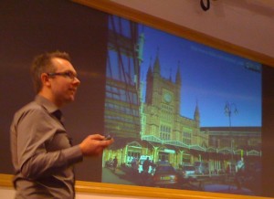
Liz Ratcliffe from Ordnance Survey gave us a brief history of geography, complete with some great slides, explaining how much of the subject is about linking different aspects of geography together, whether it be information about physical geography, climatology, coastal data, environmental data, glaciology and so on. Liz was the first to mention the geographical concept of topographical identifiers (TOIDs). Geography uses TOIDs to connect information, with every geographical feature being described by its TOID. It’s also possible to ‘hang’ your own information on TOIDs. The difference between the concepts of location and place were explained, location being a point or position in physical space, and place being a portion of space regarded as distinct and measured off. Liz concluded with the seemingly obvious, but perhaps taken for granted observation that “everything happens somewhere”. Tom Heath made the point on twitter that the next step here is to make the links between the topographic IDs explicit, and then expose them to the Web as http URIs. John Goodwin reported that he’s “working on it”, so it sounds like we can look forward to some progress here.
Silver Oliver from the BBC stood in for a mysteriously absent Tom Scott. It was more or less a re-run of his Linked Data London talk on what the BBC are doing in the area of news and journalism, and is covered below.
Next up was an unscheduled surprise guest, none other than ‘inventor of the Web’, Sir Tim Berners-Lee himself for a quick pep talk, expressing how crucially important geo-spatial data is for Linked Data. He observed that one of the first things people do is to map things. This is very valuable information, so we need to surface this geospatial data in ways that can be linked. Surprise guest star number two, Nigel Shadbolt from the University of Southampton and ‘Information Advisor’ to the Prime Minister, then took to the podium for a lightning talk on data.gov.uk. He gave part of the credit for the fact that data.gov.uk was launched on time to agile programming methodologies, and suggested this was worthwhile considering when thinking about procurements. He then gave us a quick tour of some of the interesting work going on, including the ASBOrometer iPhone app that measures the level of anti-social behaviour at your current geo-location based on data from data.gov.uk.
John Sheridan from the UK Government’s Office of Public Sector Information (OPSI), then talked some more about data.gov.uk. He mentioned that an important part of the data.gov.uk exercise was to re-use existing identifiers by co-opting them for things when moving them into the Linked Data space. The point is to not start anew. They’re trying to find ways to make publishing data in RDF form as easy as possible by finding patterns for doing things based on Christopher Alexander’s design patterns ideas. He also asked “how the hell would we meet the INSPIRE directives without Linked Data?”. These directives require the assignment of identifiers for spatial objects and the publishing of geospatial information. Now that data.gov.uk has been launched, the next step is to build capability and tools around the design patterns they’ve been constructing.
Brian Higgs from Dudley Metropolitan Borough Council talked a little about how location is important for local government in delivering its services, for which geo-information services are business critical. Ian Holt, Senior Technical Product Manager for Ordnance Survey Web Services then spoke about some of the interesting map things that have been happening as result of Web 2.0. He illustrated how it’s possible to create your own maps with a GPS unit using the Open Street Map service. He mentioned how the world community had filled in the data on the Haiti open map following the recent earthquakes, greatly helping the recovery effort. Tim Berners-Lee also referred to this in a recent TED talk.
Hugh Glaser from the University of Southampton closed the presentations with some technical demonstrations of sameAs.org, a service that helps you to find co-references between different data sets, and rkbexplorer.com, a ‘human interface to the ReSIST Knowledge Base’. A sameAs.org search on for example, John Coltrane will give you a set of URIs that all refer to the same concept of John Coltrane. Hugh admitted that gathering all the links is a challenge, and that some RDF is not reliable. All that’s needed to have a ‘same as‘ data problem, is for one person to state that the band ‘Metallica’ is the same as the album ‘Metallica’. Hugh also alluded to some of issues around trusting data, leading Chris Gutteridge to make a mischievous suggestion, “Hughs examples of sameAs for metallica gives me an evil idea: sameAs from bbc & imdb to torrents on thepiratebay”. I raised this as an issue for Linked Data on twitter leading to a number of responses, Ben O’Steen suggesting that “If people are out to deceive you, or your system, they will regardless of tech. Needing risk management is not new!”. I think this is a fair point. Many of these same issues have been tackled in that past, for example in the area of relational databases. The adoption of Linked Data is still fairly new, and it seems perfectly plausible that Linked Data will be able to address and resolve these same issues in time.
All in all, it was a great day, with the strong sense that real things are happening, and a great sense of excitement and optimism for the future of open, linked and geo-located data.
The full archive of #terrafuture tweets is available via twapper.


